Description
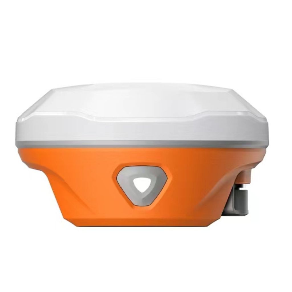
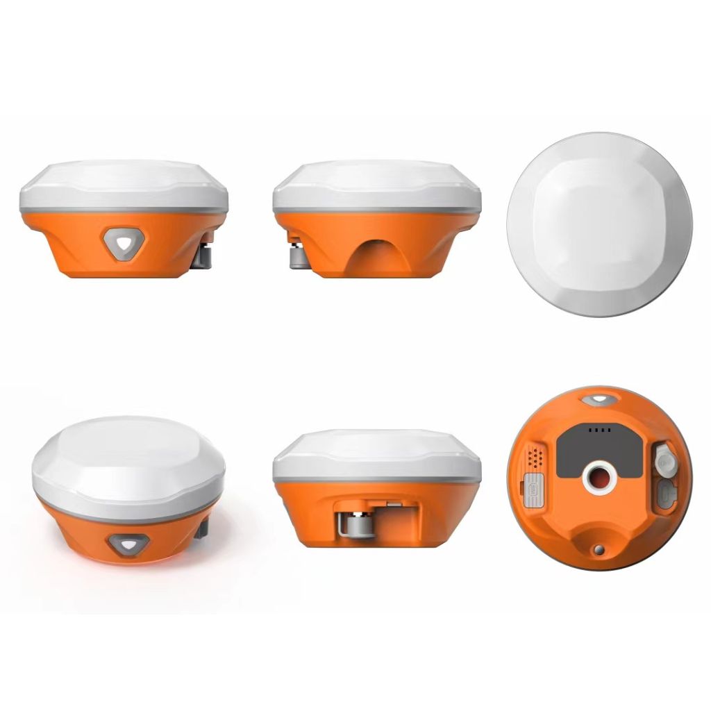
The A9 Smart Antenna is an advanced GNSS receiver designed for high performance, reliability, and ease of use. It features the Septentrio Mosaic-X5 GNSS module, the A9 provides advanced signal tracking across all global constellations, offering rapid fix times even in the most challenging & demanding environments. With built-in support for tilt collecting mode, users can achieve precision without the need for calibration, ready to start collecting data in seconds.
The A9 excels in versatility, supporting a wide range of communication options including UHF, Wi-Fi, Bluetooth, and LTE, and offers an impressive 15 km communication range. Whether you’re collecting data in remote areas or urban environments, the A9 ensures maximum accuracy with coordinates verified twice. Additionally, its robust IP68-rated housing ensures reliability in harsh conditions, withstanding drops and exposure to water and dust.
It is equipped with a 2W internal UHF Rx/Tx radio and a high-performance camera for guidance, the A9 is designed to meet the needs of both amateur surveyors and experienced professionals. It also supports easy data transfer via USB, Wi-Fi, or FTP, and integrates seamlessly with both proprietary and official Septentrio WebUI interfaces.
High-Performance GNSS Core: Powered by the Mosaic-X5 GNSS module for exceptional precision.
Fast and precise positioning: across all global systems is ensured by global constellation support.
Reliable Signal Acquisition: Delivers top performance even in difficult conditions.
Instant Operation: No calibration is needed, and data collection is ready in a matter of seconds.
Long-range communication: a 15-kilometer-range integrated 2W UHF Rx/Tx radio.
Dual Web Interface: For convenience, access through the official Septentrio WebUI and the proprietary WebUI.
Robust Design & Long Battery Life: IP68-rated for resistance to dust and water, and drop-tested up to two meters. It can run in rover mode for 15 hours and in static mode for up to 20 hours.
Applications of smart antennas:
Surveying and Mapping: Precise measuring and mapping of land, buildings, and natural features are made possible by advanced GNSS technology, which guarantees accurate representation for infrastructure development, property boundary determination, and urban planning. Hydrographic surveying, cadastral mapping, and topographic surveys are some examples of applications.
Agriculture and Land Management: GNSS systems facilitate optimized resource planning and crop monitoring through precision farming techniques, including variable-rate application of fertilizers, accurate seed placement, and efficient water management. These methods enhance productivity while promoting sustainable farming practices.
Environmental Monitoring: Natural changes including erosion, deforestation, glacier movements, and wildlife patterns are tracked and analyzed using accurate GNSS data. This data aids in the effective implementation of conservation plans and the resolution of environmental issues by scientists and policymakers.
Construction and Civil Engineering: Because high-precision GNSS receivers allow for perfect structural element arrangement and real-time positioning of construction equipment, they guarantee accuracy in building projects, site grading, and infrastructure development. This improves project productivity and lowers errors.
GIS Data Collection: In order to collect high-quality geospatial data for the production of intricate maps, 3D models, and analytics, GNSS receivers are essential. These tools are essential for utility management systems, disaster relief, and urban planning.
Remote and Urban Navigation: Reliable navigation is made possible by GNSS technology in both congested metropolitan areas with poor satellite visibility and isolated areas like mountains and deserts. Applications include emergency response, outdoor excursions, and logistics route optimization.
Forestry and Forestry Management: Systems with GNSS capabilities help with mapping tree inventories, planning sustainable forestry practices, and monitoring forest resources. These systems support biodiversity conservation initiatives, monitor trends in deforestation, and evaluate timber yield.
Autonomous Vehicles: Innovative Drones, self-driving automobiles, and other autonomous systems can navigate and position themselves precisely thanks to GNSS technologies. Through seamless control integration with sensors and AI systems, GNSS guarantees that these vehicles can function safely and effectively, even in challenging conditions.
How accurate is the A9 Smart Antenna’s positioning?
In code differential mode, the A9 provides vertical precision of 0.80m (RMS) and horizontal accuracy of 0.40m (RMS). The accuracy is 8 mm ± 1 ppm horizontally and 15 mm ± 1 ppm vertically in real-time kinematic (RTK) mode.
How do I connect the A9 to the WebUI?
Both Septentrio’s standard WebUI and our own WebUI are supported by the A9. For direct data transfer, you can connect via USB Type-C or Wi-Fi.
What is the maximum tilt angle for data collection?
The A9 supports a maximum tilt angle of 60° for tilt collecting mode, ensuring that you can collect data even in challenging conditions without leveling the pole.
How long can the A9 operate on a single charge?
The A9 operates for up to 20 hours in static mode and 15 hours in rover mode, providing ample power for extended field use.
What types of differential formats does the A9 support?
The A9 supports RTCM 2.1, 2.3, 3.0, 3.1, 3.2, NMEA 0183, PJK Plane Coordinates, Binary Code, Trimble GSOF, VRS, FKP, MAC, and is fully NTRIP supportable.
Is the A9 waterproof and durable?
Yes, the A9 is IP68-rated, meaning it is dustproof and waterproof, and it can withstand drops from up to 2 meters and 40G shock (10ms sawtooth wave).
How can I transfer data from the A9?
Data can be transferred via Wi-Fi, FTP/HTTP, USB Type-C, or external USB pen drive. The A9 also supports direct data download through its WebUI.

