Description
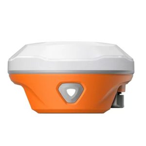
The HB6 GNSS receiver is designed to deliver exceptional performance for a wide range of demanding applications that require the highest level of precision. It is built on Septentrio Mosaic X5/H core, the HB6 offers reliable, high-accuracy positioning in dynamic conditions. It integrated with AIM+, IONO+, and APME+ technologies, this receiver enhances signal quality, reduces ionospheric interference, and ensures robust performance even in challenging conditions.
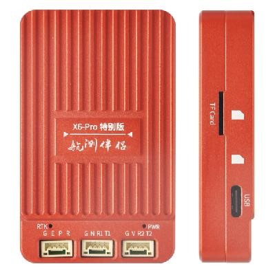
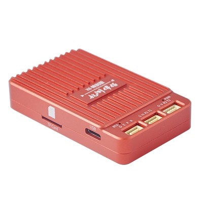
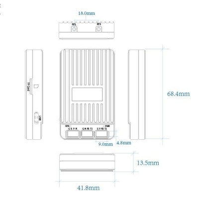
With compact design and dimensions of 68.4mm x 41.8mm x 13.5mm, the HB6 Mosaic X5/H is optimized for flexibility and can be consistently coordinated into different frameworks. Its small form factor makes it ideal for applications where space is limited, such as mapping, surveying, & autonomous vehicles.
The HB6 GNSS receiver is an ideal choice due to its flexible integration options, making it easy to integrates into existing workflows or new projects. Its robust design ensures it can handle challenging environments, from urban to remote areas, delivering accurate GNSS data with every use.
HB6 Specifications
- GNSS Core: Septentrio Mosaic X5/H
- Specials: AIM+, IONO+, APME+
- Size: 68.4mm x 41.8mm x 13.5mm
- GNSS Constellations Supported: GPS, GLONASS, Galileo, BeiDou, and more
MOSAIC-X5 module features:
- 31.0 x 31.0 x 4.2 mm LGA package
- Supports all-constellatiion multi-frequency on-chip RTK positioning and dual-antenna heading solution
- Supports GPS L1/L2, BDS B1I/B2I/B3I, GLONASS G1/G2, Galileo E1/E5b and QZSS L1/L2
- All-system multi-frequency RTK engine and advanced RTK technology
- AIM+: Industry leading Anti-jamming, Anti-sppofing Interference Monitoring and Mitigation
- IONO+: Advanced protection against ionospheric disturbances to GNSS signals
- APME+: a posteriori multipath estimator for code and phase multipath mitigation
- LOCK+: superior tracking robustness under heavy mechanical shocks or vibration
- RAIM+: Advanced Receiver Autonomous Integrity Monitoring
Performance Specifications:
Frequency
- GPS L1C/A, L1PY, L2C, L2P, L5
- BDS B1I, B1C, B2a, B2b, B2I, B3
- GLONASS L1CA, L2CA, L2P, L3 CDMA
- Galileo E1, E5a, E5b, E5 AltBoc, E6
- QZSS L1C/A, L1C/B, L2C, L5
- Navic L5
- SBAS: Egnos, WAAS, GAGAN, MSAS, SDCM (L1,L5)
- On-module L-band
Single point positioning (RMS):
- Horizontal: 1.2 m
- Vertical: 1.9 m
- Time Precision(xPPS out) – 5 ns
- Data Update Rate: 100 Hz
DGPS (RMS):
- Horizontal: 0.4 m
- Vertical: 0.7 m
- Cold start < 45 s
- Initialization Time < 7 s (typical)
- Data Update Rate: 100 Hz
RTK (RMS):
- Horizontal: 0.6 cm + 0.5 ppm
- Vertical: 1cm + 1 ppm
- Data Update Rate: 100 Hz
- Differential Data – RTCM V2.x, V3.X (MSM included), CMR v2.0/CMR+ (input only)
- Data Format – NMEA-0183, v2.3, v3.03, v4.0, RINEX v2.x, v3.x, Septentrio Binary Format (SBF)
Physical Characteristics:
- Packaging: 239 pin LGA
- Dimension: 31.0 × 31.0 × 4.2 mm
- Weight: 6.8g
Environmental Specifications:
- Working temperature: -40 °C ~ +85 °C
- Storage temperature: -55 °C ~ +85°C
- Humidity: 95% No condensation
- Vibration: MIL-STD-810G
Communication Interfaces:
- 4 × UART (3 with hardware flow control)
- 1 × USB (2.0, HS)
- 1 × Ethernet (RMII/MDIO), 10/100 Mbps
- 1 x SD memory card
- 2 x Event inputs
- 2 x GPIO
- 1 x PPS out
MOSAIC-H module features:
- 31.0 x 31.0 x 4.2 mm LGA package
- Supports all-constellatiion multi-frequency on-chip RTK positioning and dual-antenna heading solution
- Supports GPS L1/L2, BDS B1I/B2I/B3I, GLONASS G1/G2, Galileo E1/E5b and QZSS L1/L2
- All-system multi-frequency RTK engine and advanced RTK technology
- AIM+: Industry leading Anti-jamming, Anti-sppofing Interference Monitoring and Mitigation
- IONO+: Advanced protection against ionospheric disturbances to GNSS signals
- APME+: a posteriori multipath estimator for code and phase multipath mitigation
- LOCK+: superior tracking robustness under heavy mechanical shocks or vibration
- RAIM+: Advanced Receiver Autonomous Integrity Monitoring
Performance Specifications:
Frequency
- GPS L1C/A/L2P (Y)/L2C
- BDS B1I/B2I/B3I
- GLONASS G1/G2
- Galileo E1/E5b
- QZSS L1C/A, L1C/B, L2C
Single point positioning (RMS):
- Horizontal: 1.2 m
- Vertical: 1.9 m
- Time Precision(xPPS out) – 5 ns
- Data Update Rate: 100 Hz
DGPS (RMS):
- Horizontal: 0.4 m
- Vertical: 0.7 m
- Cold start < 45 s
- Initialization Time < 1 s (typical)
- Data Update Rate: 50 Hz
RTK (RMS):
- Horizontal: 0.6 cm + 0.5 ppm
- Vertical: 1cm + 1 ppm
- Data Update Rate: 20 Hz
- Differential Data – RTCM V2.x, V3.X (MSM included), CMR v2.0/CMR+ (input only)
- Data Format – NMEA-0183, v2.3, v3.03, v4.0, RINEX v2.x, v3.x, Septentrio Binary Format (SBF)
Physical Characteristics:
- Packaging: 239 pin LGA
- Dimension: 31.0 × 31.0 × 4.2 mm
- Weight: 6.8g
Environmental Specifications:
- Working temperature: -40 °C ~ +85 °C
- Storage temperature: -55 °C ~ +85°C
- Humidity: 95% No condensation
- Vibration: MIL-STD-810G
Communication Interfaces:
- 4 × UART (3 with hardware flow control)
- 1 × USB (2.0, HS)
- 1 × Ethernet (RMII/MDIO), 10/100 Mbps
- 1 x SD memory card
- 2 x Event inputs
- 2 x GPIO
- 1 x PPS out
Features of HB6:
Septentrio Mosaic X5/H Core: Provides high-precision GNSS performance.
AIM+: Advanced interference mitigation for reliable signal reception in challenging environments.
IONO+: Corrects ionospheric errors for improved accuracy.
APME+: Augments GNSS data for enhanced positioning in difficult scenarios.
Compact Size: 68.4mm x 41.8mm x 13.5mm, designed for easy integration into various systems.
Wide Compatibility: Supports multiple GNSS constellations and frequencies.
High Performance: Reliable, real-time data delivery for demanding applications.
Low Power Consumption: Energy-efficient design for extended operational life.
Applications of HB6 Mosaic X5/h:
Surveying and Mapping: provides the centimeter-level positioning accuracy needed for land surveying, infrastructure building, and topographic mapping. Even in harsh settings like urban canyons or wooded areas, GNSS systems guarantee data reliability.
Autonomous Vehicles: allows for lane-level accuracy and real-time navigation, which are essential for autonomous vehicles, drones, and marine vessels. Even in complicated surroundings or with heavy traffic, GNSS systems guarantee safe and effective operation.
UAVs (Unmanned Aerial Vehicles): enhances applications like aerial mapping, inspection, and search-and-rescue operations by providing high-precision GNSS data for waypoint navigation, UAV flight planning, and georeferenced image capture.
Robotics: makes it easier for industrial robots, autonomous mobile robots (AMRs), and outdoor robots used in environmental monitoring, logistics, and agriculture to locate and navigate using GNSS. Task accuracy and efficiency are increased by dependable placement.
Geophysical Studies: facilitates sophisticated geodetic measurements for seismic monitoring, crustal deformation analysis, and tectonic studies. Sea-level rise research and glacier tracking are two other environmental monitoring tasks made easier by GNSS systems.
Agriculture: enables precision farming methods such as crop health monitoring, field mapping, variable rate seeding, and automated tractor steering. GNSS systems optimize farm management, boost yields, and utilize fewer resources.
Which GNSS constellations are compatible with the HB6?
The HB6 ensures the best positioning accuracy in a variety of situations by supporting several GNSS constellations, such as GPS, GLONASS, Galileo, and BeiDou.
What is the HB6 GNSS receiver’s dimensions?
With its small size (68.4 mm W x 41.8 mm L x 13.5 mm H), the HB6 can be integrated into a variety of applications.
Can the HB6 be used for autonomous vehicle applications?
Yes, the HB6 is ideal for autonomous vehicle applications, offering reliable, high-accuracy GNSS data that supports navigation and positioning.
What are the key advantages of the AIM+, IONO+, and APME+ features?
AIM+ helps mitigate interference, IONO+ corrects ionospheric errors, and APME+ enhances GNSS data for more accurate and robust positioning, even in challenging environments.
Is the HB6 energy-efficient?
Yes, the HB6 is appropriate for long-term deployment in a variety of applications because to its low power consumption architecture.

