Description
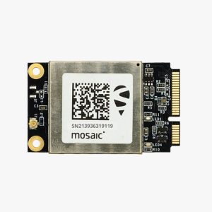
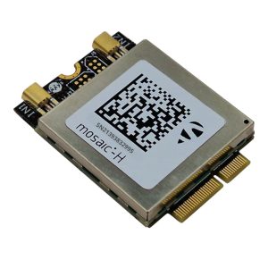
The simpleRTK3A Micro is a cutting-edge GNSS (Global Navigation Satellite System) receiver, tailored for high-precision applications that demand both accuracy and ease of integration. Powered by Septentrio’s Mosaic-X5 and Mosaic-H modules, this compact receiver is designed to accelerate your RTK (Real-Time Kinematic) projects by simplifying complex RF design and module integration.
With its small footprint and integrated RF connector, the simpleRTK3A Micro is the perfect choice for applications where space, reliability, and precision are paramount. Whether you are working on UAVs, robotics, precision agriculture, or surveying equipment, this receiver allows you to focus on your PCB design and application development without worrying about intricate GNSS integration challenges.
MOSAIC-X5 module features:
- 31.0 x 31.0 x 4.2 mm LGA package
- Supports all-constellatiion multi-frequency on-chip RTK positioning and dual-antenna heading solution
- Supports GPS L1/L2, BDS B1I/B2I/B3I, GLONASS G1/G2, Galileo E1/E5b and QZSS L1/L2
- All-system multi-frequency RTK engine and advanced RTK technology
- AIM+: Industry leading Anti-jamming, Anti-sppofing Interference Monitoring and Mitigation
- IONO+: Advanced protection against ionospheric disturbances to GNSS signals
- APME+: a posteriori multipath estimator for code and phase multipath mitigation
- LOCK+: superior tracking robustness under heavy mechanical shocks or vibration
- RAIM+: Advanced Receiver Autonomous Integrity Monitoring
Performance Specifications:
Frequency
- GPS L1C/A, L1PY, L2C, L2P, L5
- BDS B1I, B1C, B2a, B2b, B2I, B3
- GLONASS L1CA, L2CA, L2P, L3 CDMA
- Galileo E1, E5a, E5b, E5 AltBoc, E6
- QZSS L1C/A, L1C/B, L2C, L5
- Navic L5
- SBAS: Egnos, WAAS, GAGAN, MSAS, SDCM (L1,L5)
- On-module L-band
Single point positioning (RMS):
- Horizontal: 1.2 m
- Vertical: 1.9 m
- Time Precision(xPPS out) – 5 ns
- Data Update Rate: 100 Hz
DGPS (RMS):
- Horizontal: 0.4 m
- Vertical: 0.7 m
- Cold start < 45 s
- Initialization Time < 7 s (typical)
- Data Update Rate: 100 Hz
RTK (RMS):
- Horizontal: 0.6 cm + 0.5 ppm
- Vertical: 1cm + 1 ppm
- Data Update Rate: 100 Hz
- Differential Data – RTCM V2.x, V3.X (MSM included), CMR v2.0/CMR+ (input only)
- Data Format – NMEA-0183, v2.3, v3.03, v4.0, RINEX v2.x, v3.x, Septentrio Binary Format (SBF)
Physical Characteristics:
- Packaging: 239 pin LGA
- Dimension: 31.0 × 31.0 × 4.2 mm
- Weight: 6.8g
Environmental Specifications:
- Working temperature: -40 °C ~ +85 °C
- Storage temperature: -55 °C ~ +85°C
- Humidity: 95% No condensation
- Vibration: MIL-STD-810G
Communication Interfaces:
- 4 × UART (3 with hardware flow control)
- 1 × USB (2.0, HS)
- 1 × Ethernet (RMII/MDIO), 10/100 Mbps
- 1 x SD memory card
- 2 x Event inputs
- 2 x GPIO
- 1 x PPS out
MOSAIC-H module features:
- 31.0 x 31.0 x 4.2 mm LGA package
- Supports all-constellatiion multi-frequency on-chip RTK positioning and dual-antenna heading solution
- Supports GPS L1/L2, BDS B1I/B2I/B3I, GLONASS G1/G2, Galileo E1/E5b and QZSS L1/L2
- All-system multi-frequency RTK engine and advanced RTK technology
- AIM+: Industry leading Anti-jamming, Anti-sppofing Interference Monitoring and Mitigation
- IONO+: Advanced protection against ionospheric disturbances to GNSS signals
- APME+: a posteriori multipath estimator for code and phase multipath mitigation
- LOCK+: superior tracking robustness under heavy mechanical shocks or vibration
- RAIM+: Advanced Receiver Autonomous Integrity Monitoring
Performance Specifications:
Frequency
- GPS L1C/A/L2P (Y)/L2C
- BDS B1I/B2I/B3I
- GLONASS G1/G2
- Galileo E1/E5b
- QZSS L1C/A, L1C/B, L2C
Single point positioning (RMS):
- Horizontal: 1.2 m
- Vertical: 1.9 m
- Time Precision(xPPS out) – 5 ns
- Data Update Rate: 100 Hz
DGPS (RMS):
- Horizontal: 0.4 m
- Vertical: 0.7 m
- Cold start < 45 s
- Initialization Time < 1 s (typical)
- Data Update Rate: 50 Hz
RTK (RMS):
- Horizontal: 0.6 cm + 0.5 ppm
- Vertical: 1cm + 1 ppm
- Data Update Rate: 20 Hz
- Differential Data – RTCM V2.x, V3.X (MSM included), CMR v2.0/CMR+ (input only)
- Data Format – NMEA-0183, v2.3, v3.03, v4.0, RINEX v2.x, v3.x, Septentrio Binary Format (SBF)
Physical Characteristics:
- Packaging: 239 pin LGA
- Dimension: 31.0 × 31.0 × 4.2 mm
- Weight: 6.8g
Environmental Specifications:
- Working temperature: -40 °C ~ +85 °C
- Storage temperature: -55 °C ~ +85°C
- Humidity: 95% No condensation
- Vibration: MIL-STD-810G
Communication Interfaces:
- 4 × UART (3 with hardware flow control)
- 1 × USB (2.0, HS)
- 1 × Ethernet (RMII/MDIO), 10/100 Mbps
- 1 x SD memory card
- 2 x Event inputs
- 2 x GPIO
- 1 x PPS out
- High-Precision Accuracy: It achieves centimeter-level positioning with the advanced Mosaic-X5 and Mosaic-H modules.
- Compact Design: The small form factor makes it ideal for projects with tight space constraints.
- Ease of Integration: It features an integrated RF connector and pre-engineered design to simplify implementation.
- Versatile Applications: SimpleRTK3A Micro is very suitable for UAVs, autonomous vehicles, precision mapping, robotics, and more.
- Reliable Performance: Designed for high availability and robust operation in challenging environments.
By utilizing the simpleRTK3A Micro, you gain access to a proven GNSS solution that eliminates the complexities of module integration, enabling faster development cycles and ensuring superior performance for your high-precision applications.
Surveying and Mapping: The SimpleRTK3A Micro provides accurate, high-precision data, making it ideal for the surveying and mapping industries. It is essential for creating detailed maps and conducting land surveys. Its precision ensures that survey results are both reliable and accurate.
Agriculture: The SimpleRTK3A Micro supports precision agriculture by enabling automated equipment such as automated steering and yield and field mapping. This ensures efficient results and boosts productivity.
Autonomous Vehicles: The SimpleRTK3A offers precise positioning and generates accurate data for navigation operations in autonomous vehicles, whether terrestrial or aerial (drones). This enhances safety and reliability in autonomous systems.
Construction: In construction, it is used for machine control and site surveys. It ensures accurate positioning of machinery and facilitates monitoring of construction progress with high precision.
What GNSS constellations does the SimpleRTK3A Micro support?
The SimpleRTK3A Micro is designed for precision supporting GPS, GLONASS, Galileo, and BeiDou constellations. Its multi-constellation capability delivers robust and accurate positioning & performance in various environments.
How accurate is the SimpleRTK3A Micro?
The SimpleRTK3A Micro is equipped with RTK capabilities, which deliver centimeter-level accuracy, making it ideal for high-precision applications such as surveying, autonomous navigation, and agriculture.
What interfaces does the SimpleRTK3A Micro offer?
The SimpleRTK3A Micro provides multiple connectivity options, including UART, USB, and I2C interfaces, ensuring seamless integration with various systems and devices.
Is the SimpleRTK3A Micro suitable for battery-operated applications?
Yes, the SimpleRTK3A Micro is designed for low power consumption, making it ideal for battery-operated devices and applications where power efficiency is critical.


