Description
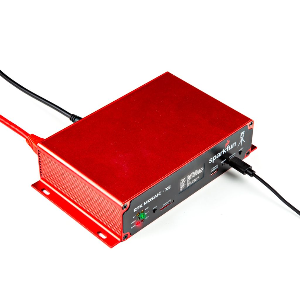
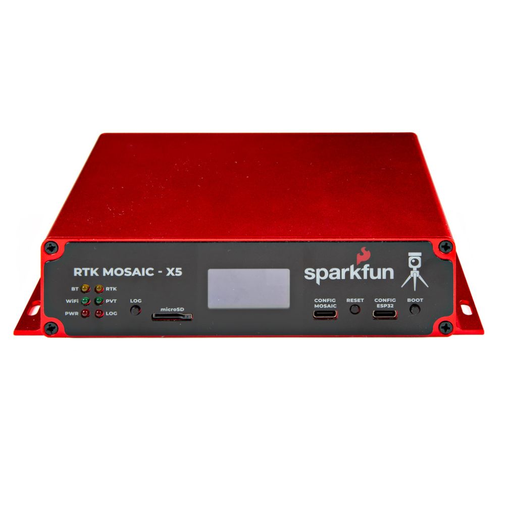
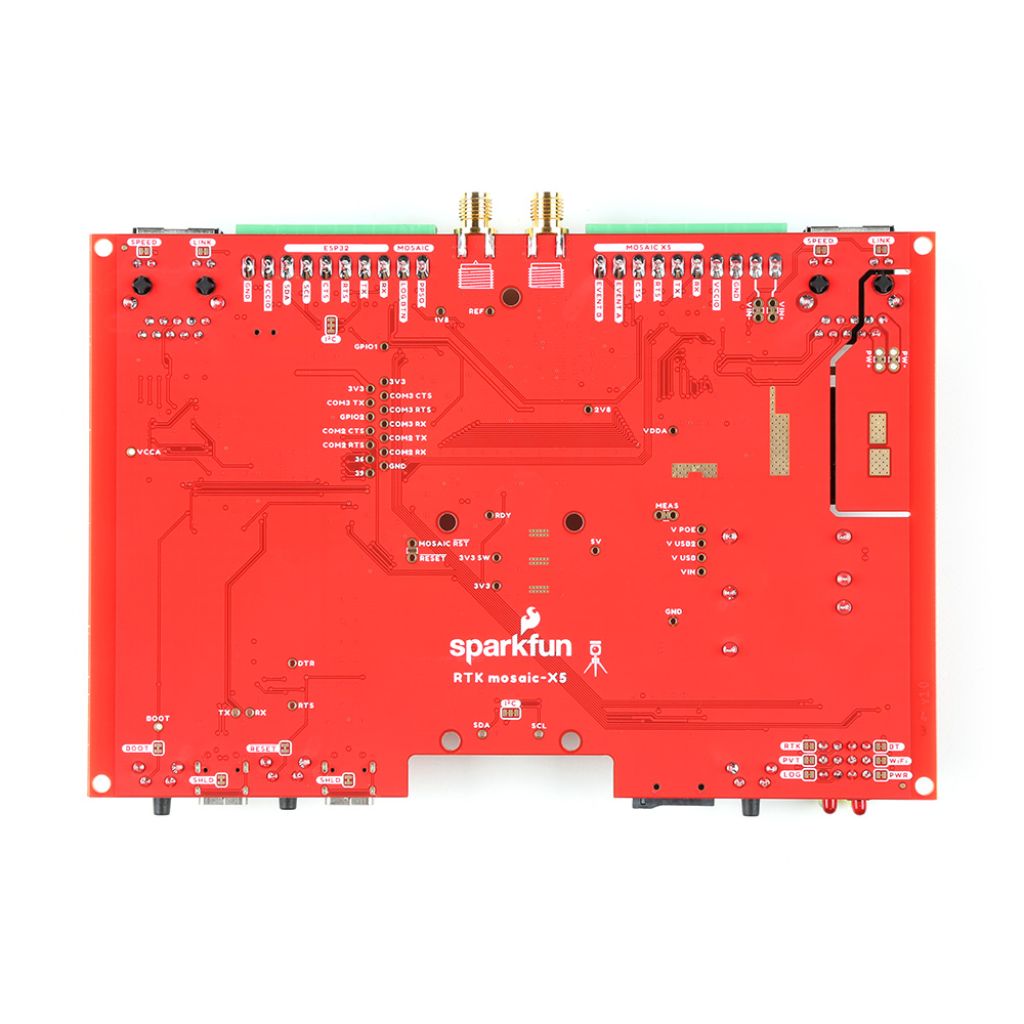
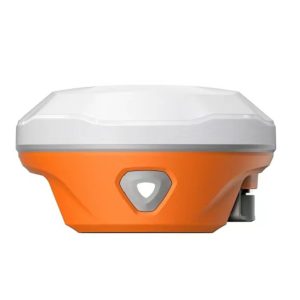
The SparkFun RTK mosaic-X5 is an enhanced GPS receiver, which is a multi constellation GNSS receiver that focuses on providing high accuracy positioning and navigation solutions. It is built on the powerful mosaic-X5 module from Septentrio, this device supports GPS, GLONASS, Galileo, Beidou, NavIC, and other satellite systems, delivering high accuracy for a wide range of applications.
With its capacity to achieve a horizontal positioning accuracy of 6mm, the mosaic-X5 excels in RTK (Real Time Kinematics) scenarios. Whether used as an RTK Base or RTK Rover, it guarantees precise real-time data collection. This powerful device can also deliver position updates at 100Hz, making it perfect for robotics and autonomous systems.
Designed for ease of use, the mosaic-X5 includes an internal web page server for configuration and position monitoring, all accessible through a standard web browser. It supports data logging in RINEX, NMEA, and SBF formats, offering flexibility for researchers and developers. With differenr connectivity options, including USB-C, Ethernet, and Power-over-Ethernet (PoE), the mosaic-X5 incoperate seamlessly into existing networks, delivering reliable performance in various environments.
Built to withstand tough conditions, the SparkFun RTK mosaic-X5 features a durable aluminum case, SMA connectors, and a range of power options to ensure uninterrupted operation. This product is ideal for precision applications requiring high-speed and accurate GNSS data.
- Septentrio mosaic-X5 multi-constellation, multi-frequency GNSS module
-
-
- Best-in-class reliable and scalable position accuracy
- Future proof: supporting current and future satellite signals
- AIM+ unique interference mitigation and monitoring system as part of the advanced GNSS+ algorithms
- Update rate of 100 Hz
- 448 hardware channels for simultaneous tracking of all visible supported satellite signals:
- GPS: L1C/A, L1PY, L2C, L2P, L5
- GLONASS: L1CA, L2CA, L2P, L3 CDMA
- Beidou: B1I, B1C, B2a, B2b, B2I, B3
- Galileo: E1, E5a, E5b, E5 AltBoc, E6
- QZSS: L1C/A, L1 C/B, L2C, L5
- NavIC: L5
- SBAS: Egnos, WAAS, GAGAN, MSAS, SDCM (L1, L5)
- On-module L-band
- Supports SBF, NMEA, RINEX, RTCM and CMR message formats
- 5 constellation RTK (base and rover)
- USB-C interface (UART and Ethernet-over-USB)
-
-
- Reverse Polarity (RP) SMA WiFi / BT antenna connection
- Provides WiFi connectivity for the mosaic-X5
- USB-C interface (UART via CH340)
- Dual KSZ8041NLI Ethernet PHY interfaces
-
-
- 10Base-T / 100Base-TX with auto-negotiate and Auto MDI/MDI-X
- mosaic-X5 and ESP32 have independent Ethernet interfaces
- mosaic-X5 can be linked directly to an external Ethernet network – optionally with PoE
- Or, mosaic-X5 can be linked to the ESP32 for WiFi connectivity
-
-
- Connected directly to the mosaic-X5 for fast data logging
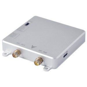
- SMA GNSS antenna connection
-
-
- 5V power for an active antenna
-
-
- Robust 3.5mm screw terminals
- Fully isolated external DC power input (9V – 36V)
- Switchable 3.3V or 5V I/O voltage
- mosaic-X5 COM1 UART: TX, RX, RTS, CTS
- mosaic-X5 EVENT-A and EVENT-B inputs
- mosaic-X5 PPSO timing pulse output
- mosaic-X5 Log button input
- ESP32 UART: TX, RX, RTS, CTS (currently unused)
- ESP32 I2C with level-shifting
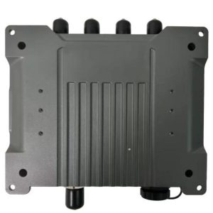
- Custom extruded aluminum case with machined end panels
-
-
- IP42 ingress protection
- A weatherproof enclosure is required for outdoor use
- Matte-effect front and rear stickers
-
-
- mosaic-X5 USB-C connector
- ESP32 USB-C connector
- Power-over-Ethernet (36V – 57V)
- External DC power (9VDC – 36VDC via screw terminals) (Fully isolated)
- Inspired by the Septentrio mowi (mosaic wireless) open-source design
MOSAIC-X5 module features:
- 31.0 x 31.0 x 4.2 mm LGA package
- Supports all-constellatiion multi-frequency on-chip RTK positioning and dual-antenna heading solution
- Supports GPS L1/L2, BDS B1I/B2I/B3I, GLONASS G1/G2, Galileo E1/E5b and QZSS L1/L2
- All-system multi-frequency RTK engine and advanced RTK technology
- AIM+: Industry leading Anti-jamming, Anti-sppofing Interference Monitoring and Mitigation
- IONO+: Advanced protection against ionospheric disturbances to GNSS signals
- APME+: a posteriori multipath estimator for code and phase multipath mitigation
- LOCK+: superior tracking robustness under heavy mechanical shocks or vibration
- RAIM+: Advanced Receiver Autonomous Integrity Monitoring
Performance Specifications:
Frequency
- GPS L1C/A, L1PY, L2C, L2P, L5
- BDS B1I, B1C, B2a, B2b, B2I, B3
- GLONASS L1CA, L2CA, L2P, L3 CDMA
- Galileo E1, E5a, E5b, E5 AltBoc, E6
- QZSS L1C/A, L1C/B, L2C, L5
- Navic L5
- SBAS: Egnos, WAAS, GAGAN, MSAS, SDCM (L1,L5)
- On-module L-band
Single point positioning (RMS):
- Horizontal: 1.2 m
- Vertical: 1.9 m
- Time Precision(xPPS out) – 5 ns
- Data Update Rate: 100 Hz
DGPS (RMS):
- Horizontal: 0.4 m
- Vertical: 0.7 m
- Cold start < 45 s
- Initialization Time < 7 s (typical)
- Data Update Rate: 100 Hz
RTK (RMS):
- Horizontal: 0.6 cm + 0.5 ppm
- Vertical: 1cm + 1 ppm
- Data Update Rate: 100 Hz
- Differential Data – RTCM V2.x, V3.X (MSM included), CMR v2.0/CMR+ (input only)
- Data Format – NMEA-0183, v2.3, v3.03, v4.0, RINEX v2.x, v3.x, Septentrio Binary Format (SBF)
Physical Characteristics:
- Packaging: 239 pin LGA
- Dimension: 31.0 × 31.0 × 4.2 mm
- Weight: 6.8g
Environmental Specifications:
- Working temperature: -40 °C ~ +85 °C
- Storage temperature: -55 °C ~ +85°C
- Humidity: 95% No condensation
- Vibration: MIL-STD-810G
Communication Interfaces:
- 4 × UART (3 with hardware flow control)
- 1 × USB (2.0, HS)
- 1 × Ethernet (RMII/MDIO), 10/100 Mbps
- 1 x SD memory card
- 2 x Event inputs
- 2 x GPIO
- 1 x PPS out
Features of Sparkfun RTK:
Multi-Constellation Support: GPS, GLONASS, Galileo, Beidou, NavIC, and additional satellite systems for comprehensive coverage.
RTK Accuracy: It can achieve 6mm horizontal accuracy for real-time positioning.
High-Speed Data: Position updates at 100Hz, ideal for robotics and autonomous systems.
Flexible Data Logging: Log data in RINEX, NMEA, or SBF formats for easy integration with other systems.
Internal Web Server: Configure and monitor the device via a web browser.
Connectivity: Includes USB-C, Ethernet, and Power-over-Ethernet (PoE) for smooth integration.
Durability: Robust design with long-lasting IO connections, SMA connectors, and an aluminum casing.
Power Options: USB-C, PoE (36V-57V), or external DC (9V-36V) for versatile power supply options.
Active Antenna: Powered via the SMA antenna connector for optimal functionality.
Applications of Sparkfun:
Robotics & Autonomous Systems: ensures dependable performance in dynamic contexts and improves operational efficiency in jobs like logistics, inspection, and delivery systems by offering high-accuracy location for navigation and control.
Precision Agriculture: enables precise fertilization, harvesting, and seed positioning, boosting output and cutting down on resource waste. It offers real-time kinematics (RTK) for surveying and agricultural automation.
Surveying & Mapping: With centimeter-level accuracy to support infrastructure planning, urban development, and environmental monitoring, it is perfect for land surveying, geospatial data collection, and mapping applications.
Construction: For better project accuracy and lower labor costs, it is utilized in construction equipment to track accurate locations and enable automated grading, machine guidance, and monitoring.
Drones & UAVs: ensures precise data collection and operational dependability by enabling high-precision navigation for drones and UAVs in difficult situations including forestry, pipeline inspection, and disaster response.
Geodesy & Geophysics: gathers information for cutting-edge research, such as tracking tectonic movements, examining the deformation of the Earth’s crust, and assisting with international geodetic infrastructure for scientific investigations.
What is RTK, and how does it work?
To increase positional accuracy, RTK (Real Time Kinematics) makes use of a GNSS receiver and corrective data streams. It allows for extremely precise real-time positioning, usually within 6mm.
What GNSS signals are supported by the SparkFun RTK mosaic-X5?
For all-encompassing coverage, the SparkFun RTK mosaic-X5 is compatible with GPS, GLONASS, Galileo, Beidou, NavIC, SBAS, and QZSS satellite systems.
How can I log data from the mosaic-X5?
You can log data in RINEX, NMEA, or SBF formats. RINEX files can be generated at different intervals and durations for precise data recording.
Can the mosaic-X5 be used for robotics and autonomous systems?
Yes, SparkFun RTK mosaic-X5 is perfect for high-speed robotics and autonomous applications because it can send position updates at up to 100 Hz
What are the power options for the mosaic-X5?
The SparkFun RTK mosaic-X5 can be powered via USB-C, Power-over-Ethernet (PoE) (36V-57V), or an external DC power supply (9V-36V).
Is there a way to access and configure the mosaic-X5 remotely?
Yes, the mosaic-X5 features an internal web page server that allows you to configure and monitor the device remotely through a standard web browser.

